이시은_Roads of 2100: Teheran-ro
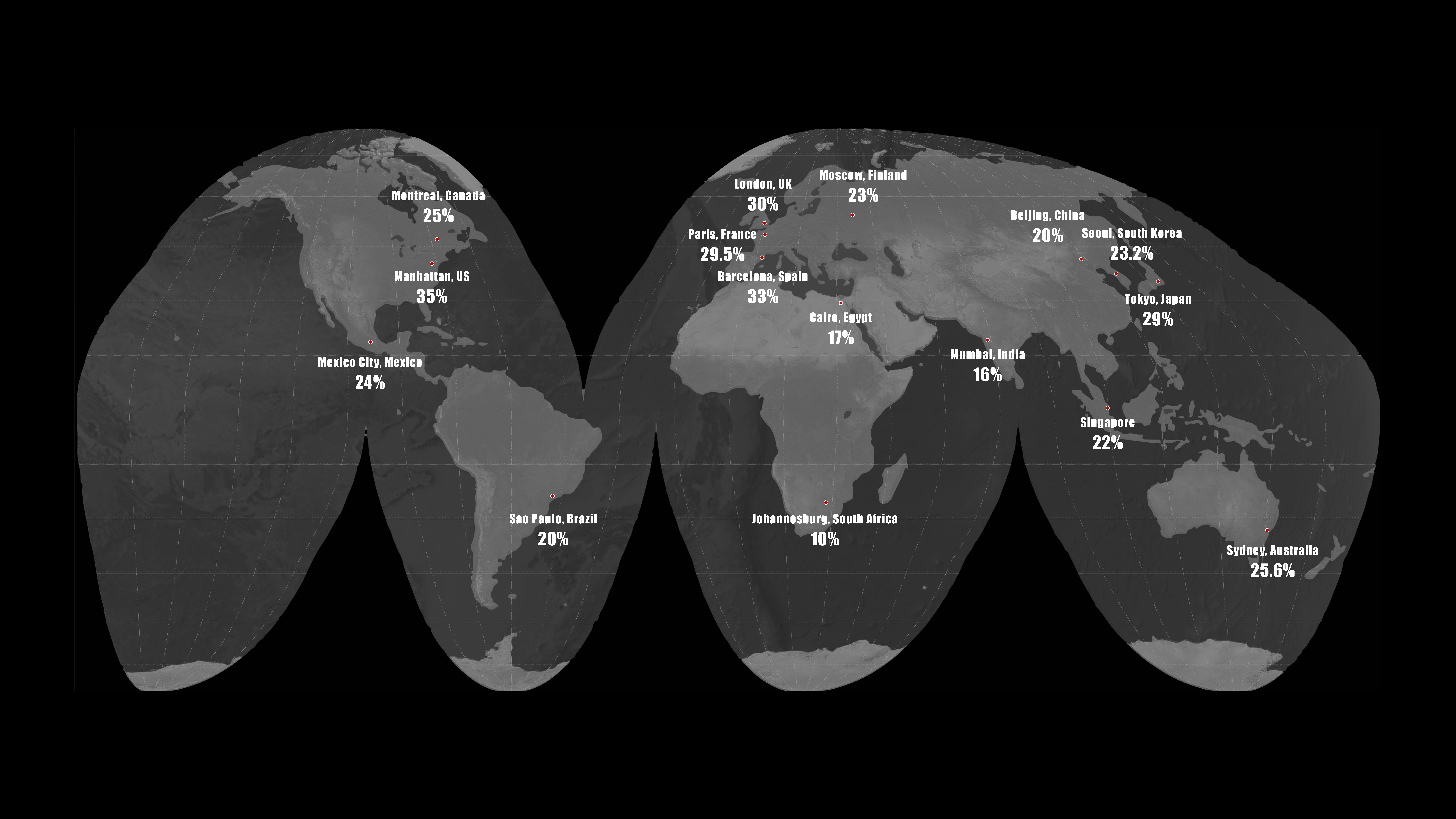
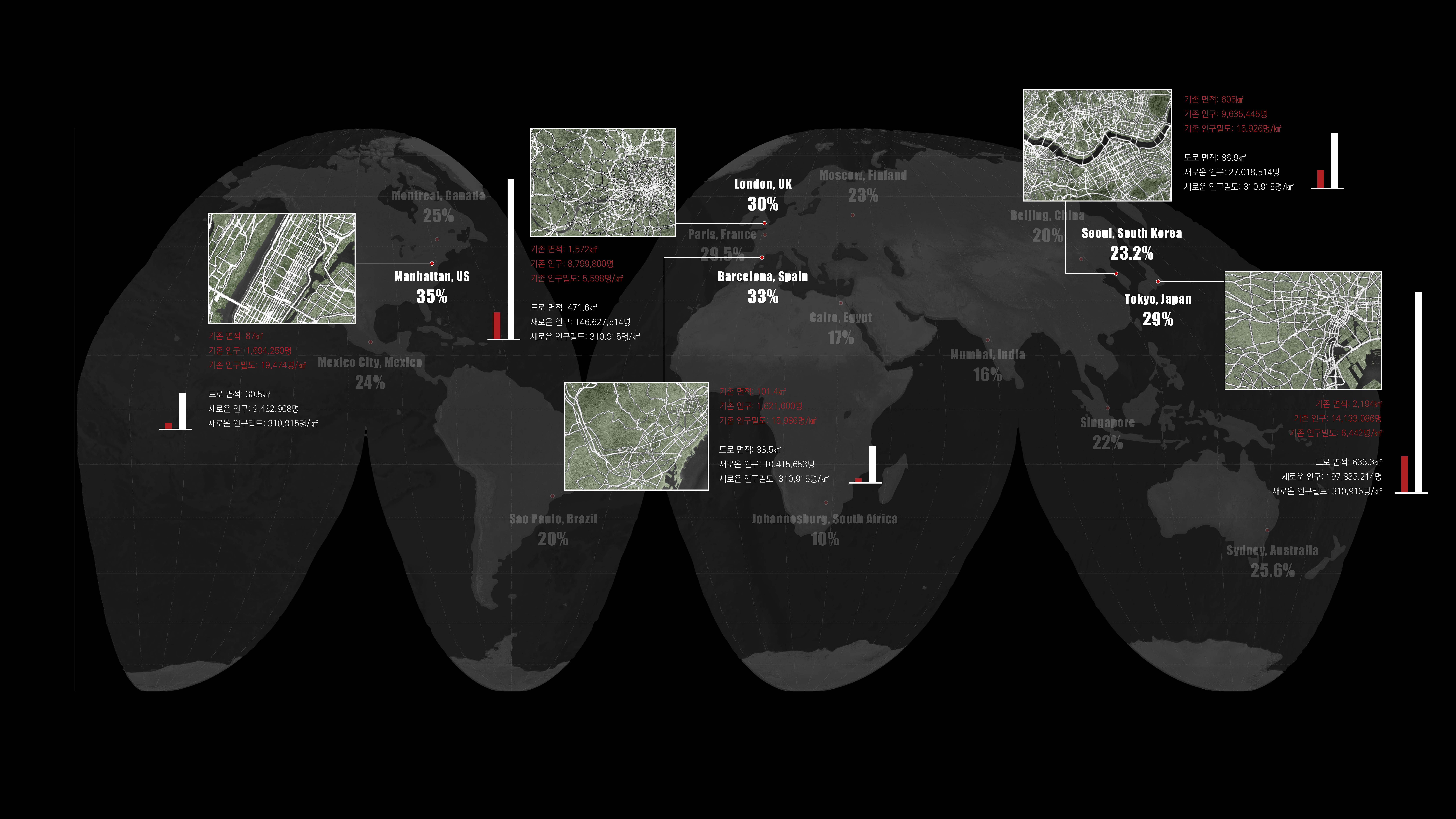
도로율은 어떤 지역에서 도로가 차지하고 있는 면적을 비율로 나타낸 값이다. 대부분의 선진국은 보통 20~30%의 도로율을 가지며, 이 중 서울은 23.2%의 도로율을 가지고 있다.
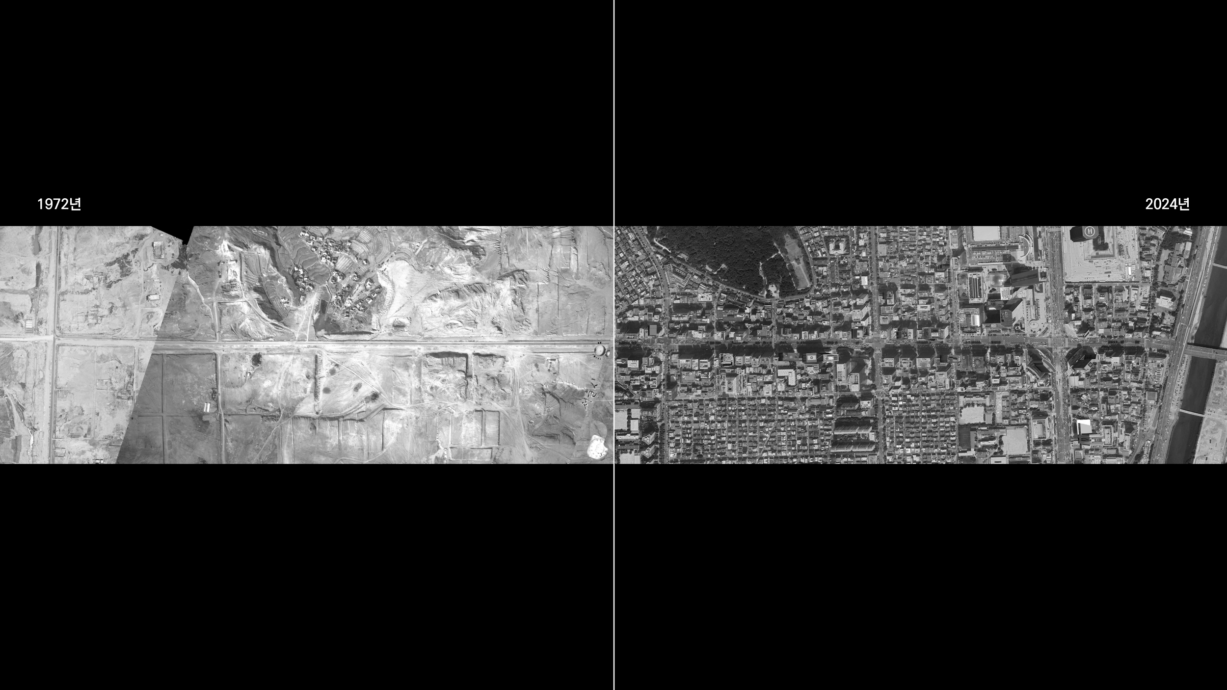
도로는 도시의 뿌리가 되는 기반시설로 도시의 모습을 형성하는데 있어 핵심적인 역할을 한다. 서울의 강남, 그 중에서도 강남의 테헤란로가 이를 잘 보여주는 예시이다. 테헤란로의 경우와 같이, 빈 땅에 도로망이 들어서고 그 양 옆으로 건물이 건설되며 도시의 모습을 형성하는 것이 일반적이다.
그러나, 더 이상 도로는 자동차를 위한 것이 아니다. 그에 따라 도로의 보행화, 녹지화 등과 같이 지속가능성을 고려한 여러가지 변화가 일어나고 있다. 차선을 축소하고 보행 광장을 확장시킨 세종대로, 도로를 지하화하여 지상을 보행자를 위한 공간으로 만들고자 계획 중인 영동대로 등이 그 예시이다. 하지만 전 세계적으로 도시 인구가 증가하고 있는 현재의 상황에서, 도시의 20~30%를 차지하는 면적을 그저 보행화, 녹지화하는 것이 정답일까? 본 프로젝트는 도로라는 새로운 면적을 보다 적극적으로 활용하고자 하는 생각에서 시작되었다.
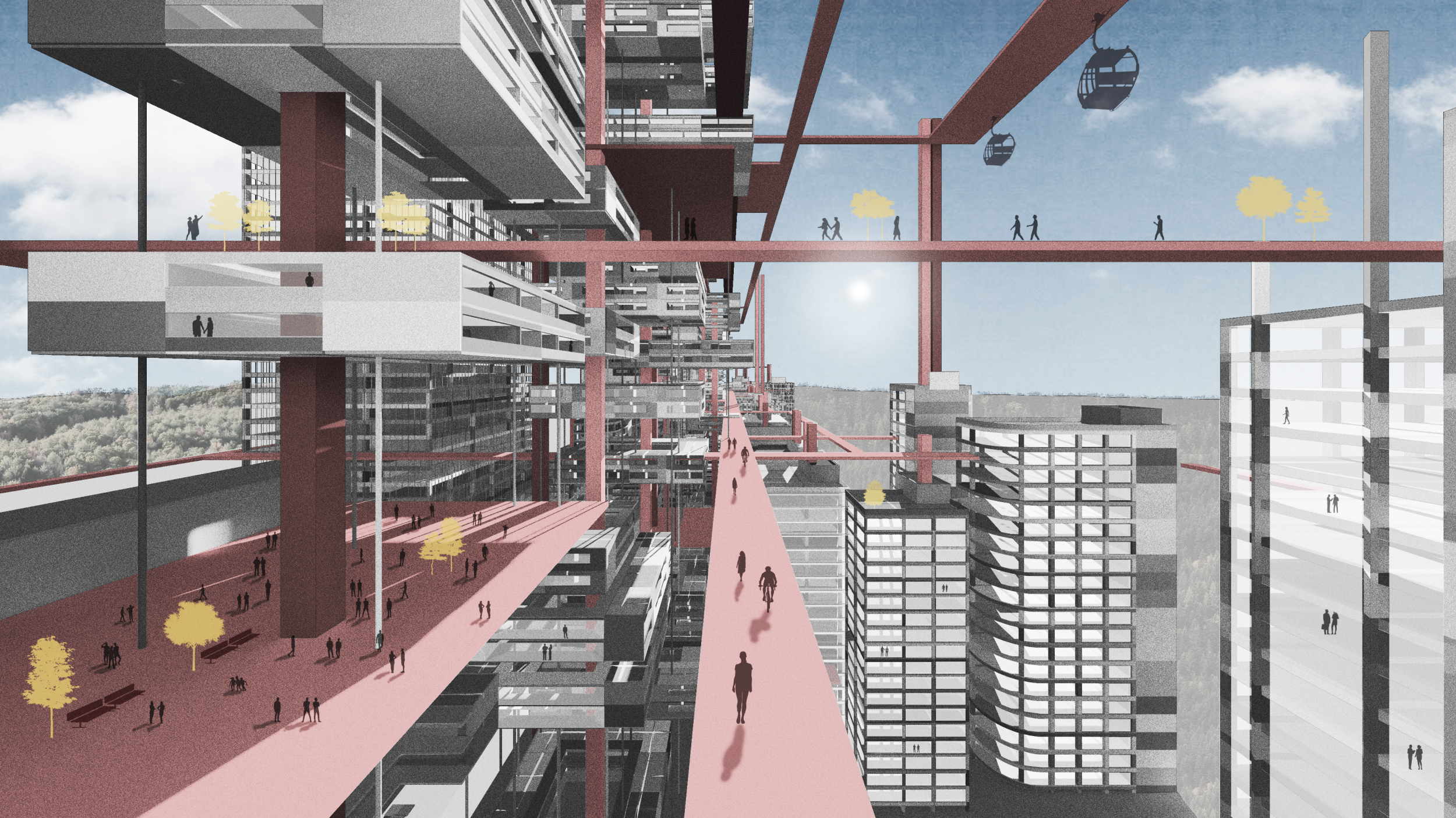
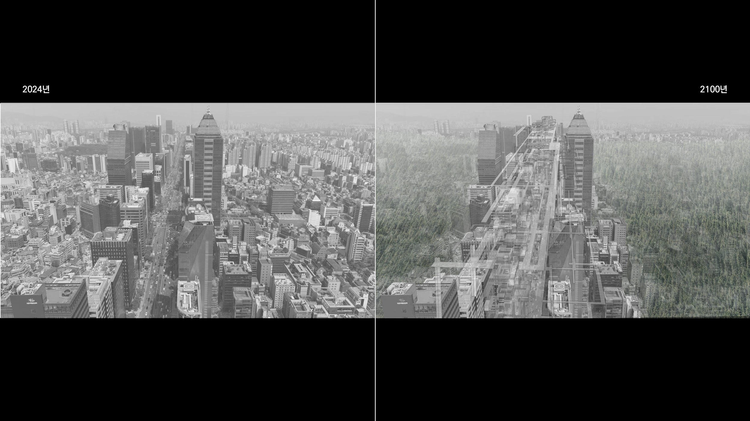
대상지는 강남의 대표거리인 테헤란로이다. 강남역부터 삼성역까지 약 4km를 직선으로 가로지는 테헤란로는 이를 경계로 한 테북, 테남이라는 용어가 있을 정도로 도시 조직을 확실하게 구분 짓는 공공 인프라이다. 북쪽과 남쪽뿐만 아니라 테헤란로 간선부의 육중한 오피스, 이면부의 상대적으로 초라한 주거시설의 차이 또한 두드러진다. 본 프로젝트에서는 도로로 인해 발생한 도시 조직의 단절을 해소하고자, 이면부의 기능을 도로로 가져와보았다.
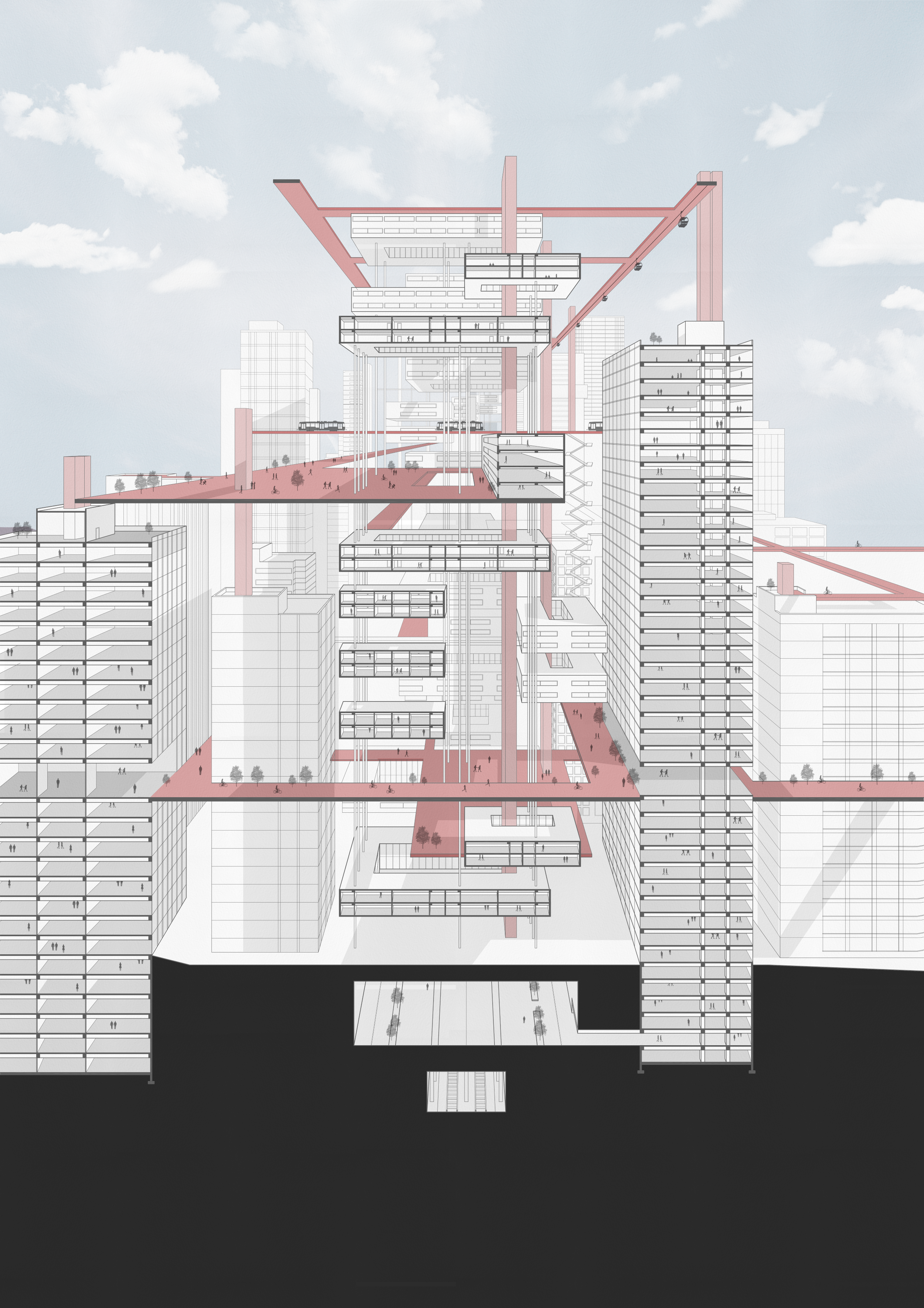
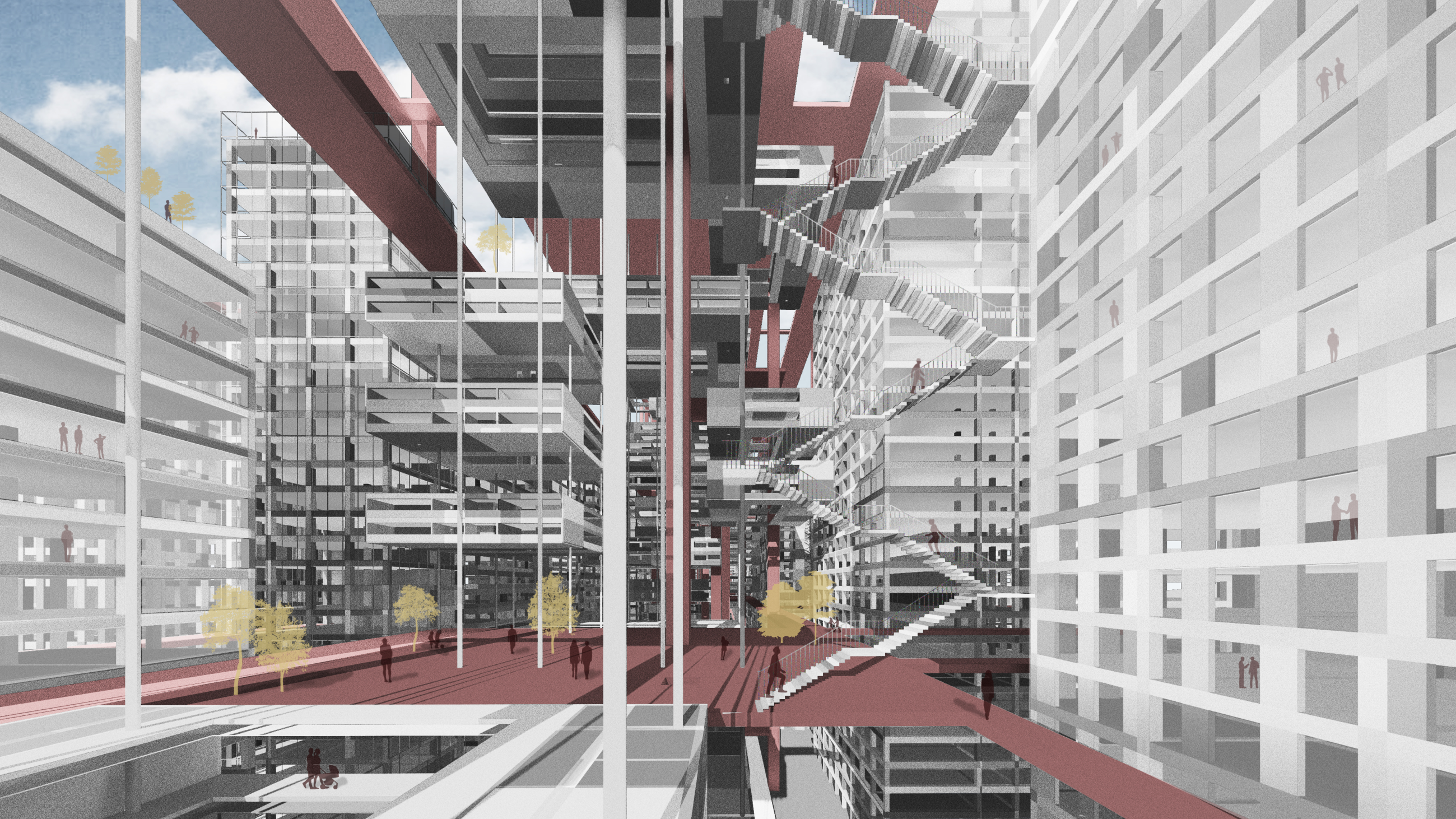
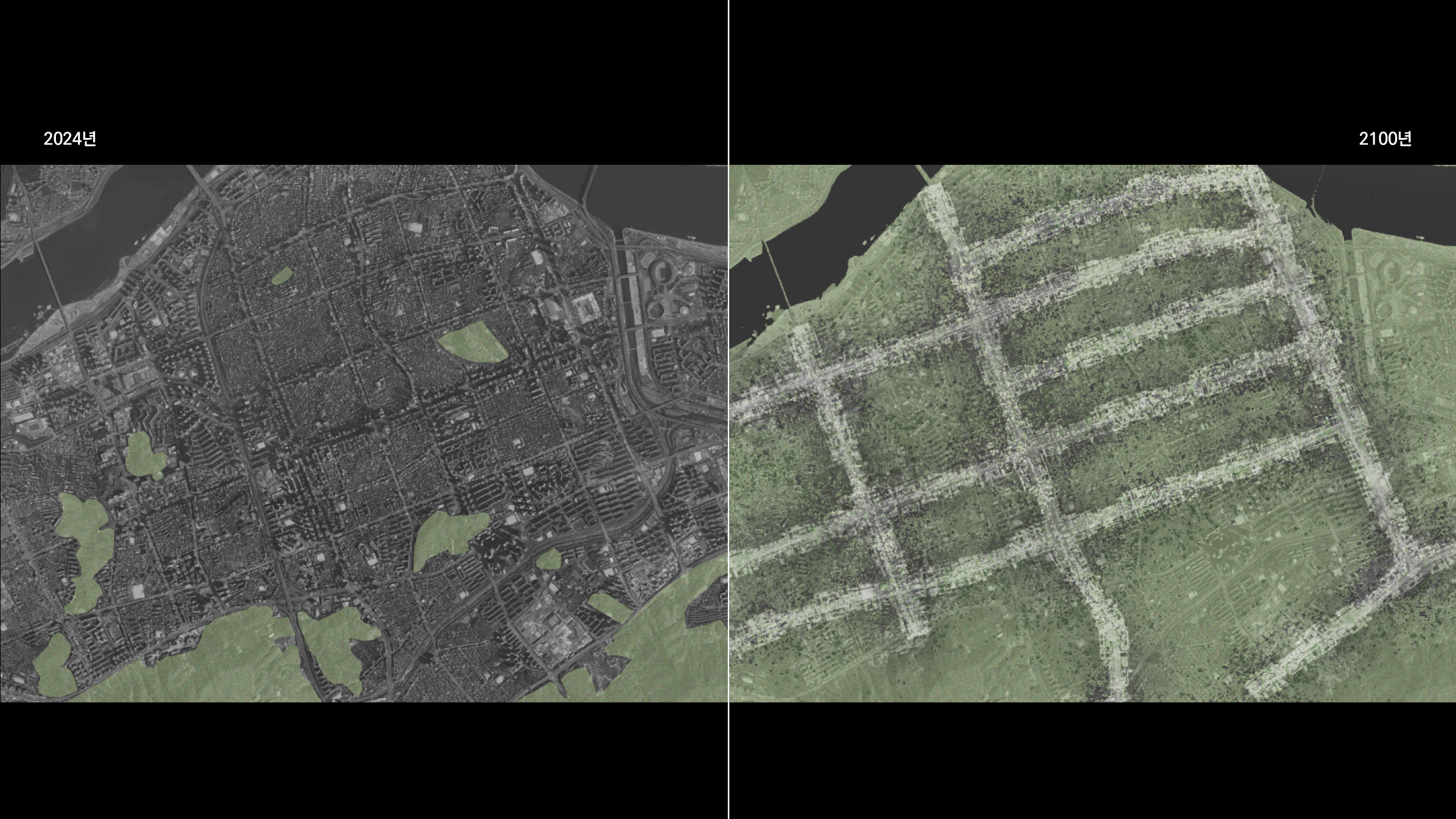
처음에는 일반적인 아파트 단지 정도의 밀도로, 도로 중앙에 공공 주거 및 공공 보행로가 설치되면 점차 주변 건물이 이에 연결하고자 할 것이다. 이것이 계속해서 잘 작동된다면 2100년이라는 미래에는 마침내 테헤란로가 주변 도시조직을 모두 흡수하게 될 것이다. 기존의 도로 위에 도시 조직이 집약되면 토지를 더욱 효율적으로 활용하면서도 지구의 지속 가능성을 유지할 수 있다. 2100년의 테헤란로에 적용한 310,915명/㎢의 인구밀도를 세계 주요 고밀도시에 적용하였을 때, 사용 면적은 줄어들면서 수용 가능한 인구수는 비약적으로 상승하게 된다.
도시로 이동하는 사람들과 고밀화 되어가는 도시, 본 프로젝트는 이러한 사이에서 지구의 미래가 바로 이것이라고 조심스럽게 제안해본다.
Road ratio refers to the percentage of an area occupied by roads. Most developed countries typically have a road ratio of 20-30%, with Seoul having a road ratio of 23.2%. Roads are a fundamental infrastructure that forms the backbone of cities, playing a crucial role in shaping their appearance. A prime example of this is Teheran-ro in Gangnam, Seoul. As seen with Teheran-ro, it is common for a road network to be established on vacant land, with buildings constructed alongside it, shaping the city's appearance.
However, roads are no longer just for cars. Various changes are being made to enhance sustainability, such as pedestrianization and greening of roads. Examples include Sejong-daero, where lanes have been reduced and pedestrian plazas expanded, and Yeongdong-daero, which is planned to be undergrounded to create a pedestrian space above. But with the current global trend of increasing urban populations, is it the right solution to simply pedestrianize or green the 20-30% of urban areas occupied by roads? This project started with the idea of more actively utilizing the area occupied by roads.
The target area is Teheran-ro, a representative street in Gangnam. Teheran-ro, which runs straight for about 4 km from Gangnam Station to Samseong Station, is a public infrastructure that clearly divides the urban fabric, so much so that terms like "Tebuk" (north of Teheran-ro) and "Tenam" (south of Teheran-ro) exist. There is also a noticeable difference between the massive office buildings on the main section of Teheran-ro and the relatively modest residential facilities in the backstreets. This project aims to eliminate the urban division caused by the road by bringing the functions of the backstreets onto the road.
Initially, if public housing and public walkways are installed in the center of the road with a density similar to that of a typical apartment complex, the surrounding buildings will gradually connect to it. If this continues to function well, by the year 2100, Teheran-ro will eventually absorb the surrounding urban fabric. By concentrating urban structures on the existing roads, we can utilize land more efficiently while maintaining the sustainability of the planet. When applying the population density of 310,915 people/km², which was applied to Teheran-ro in 2100, to major high-density cities worldwide, the area used decreases while the population capacity increases dramatically.
With people moving to cities and cities becoming denser, this project cautiously suggests that this might be the future of our planet.
